


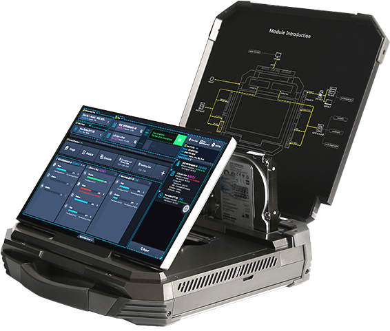

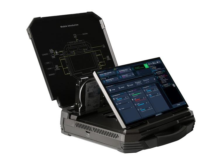
MagiCube
A portable and highly-integrated computer forensics equipment. High performance such as disk duplication rate up to 39GB/min. Customizable forensics workflows of disk duplication, analysis and OS emulation.


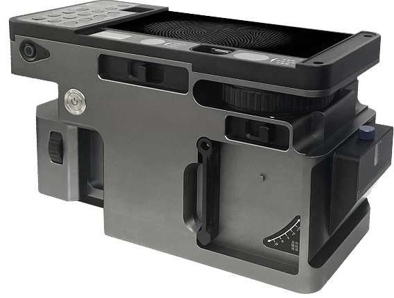
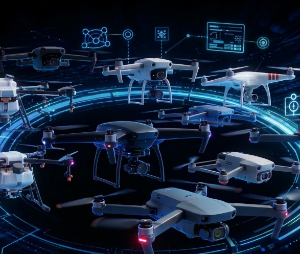
Drone Forensics Tool
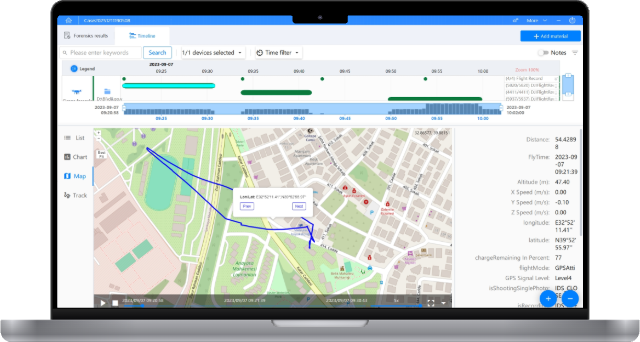
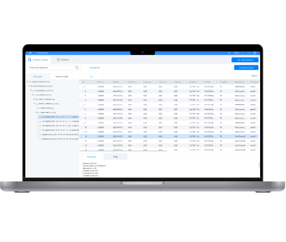
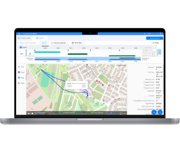
The UAV-1200 Drone Forensics Tool delivers comprehensive data extraction and analysis across a wide range of drone models from leading brands, including DJI, FreeFlight, and XIRO. By acquiring data from multiple storage media, it enables fast, reliable access to critical aircraft, battery, operator, and multimedia evidence.
Applicable Scenarios
· Digital forensics in drone-related crimes;
· Investigation of claims that an operator accidentally crashed a drone within a no-fly zone;
· Detection of smuggling activities involving drones;
· Investigation of unauthorized surveillance;
· Analysis of incidents involving aviation interference;
· Assessment of threats to (network) infrastructure.

A portable and highly-integrated computer forensics equipment. High performance such as disk duplication rate up to 39GB/min. Customizable forensics workflows of disk duplication, analysis and OS emulation.
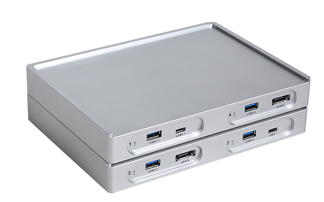
iDC-8670 Octopus Multi-protocol Forensic Acquisition Device The Multi-protocol Forensic Acquisition Device is a portable device that utilizes multiple transmission channels for non-destructive parallel acquisition of computer storage media. By analyzing various hard disk data formats, it accurately identifies valid data, maximizing the data throughput of each interface to achieve rapid acquisition of hard disks. One of the fastest acquisition devices with parallel acquisition technology, which can speed up to 50 GB/min. Designed for online/offline data acquisition from irremovable storages like servers, laptops, pads and all-in-one computers by four transfer channels.

The Watch UAV is a device that integrates detection and countermeasures. It can be flexibly deployed in key control areas to achieve 7×24 hours of automatic detection and countermeasures against drones (detection radius 3km, countermeasure radius 1km). It supports blacklist and whitelist settings, defense zone settings, precise countermeasures, etc. It can quickly locate the position of the drone and the pilot by analyzing the drone signal. It can also interfere with the drone signal to make it land or return.

Provide unmanned aerial vehicle (UAV) function for evacuation or forcedlanding, the product is lightweight and portable, suitable for individual sol-diers to carry Product size: 352mm x 310mm Interference frequencies: 2.4Ghz、5.8Ghz、433Ghz、928GHz Interference distance: > 5000 meters (in open environments) Product weight: 7.2kg.
A multi-task clone device which can complete disk-to-disk & disk-to-image duplication. Support hash verification, data wiping, image-to-disk recovery and 3-to-3 disk duplication.

7 inch Maximum load 2.5kg Flight distance 10km Flight time 9 minutes (1.6kg load, 6s 6000mah battery test result) Maximum speed 120km/h 10 inch Maximum load 4kg Flight distance 10km Flight time 8 minutes (3.5kg load, 6s 6000mah battery test result) Maximum speed 120km/h
Using ultra-wideband antennas, it can detect drones in real time, including quadcopters, drones, etc., and issue warnings through sound, light, and vibration. It can also display the detected drone models.
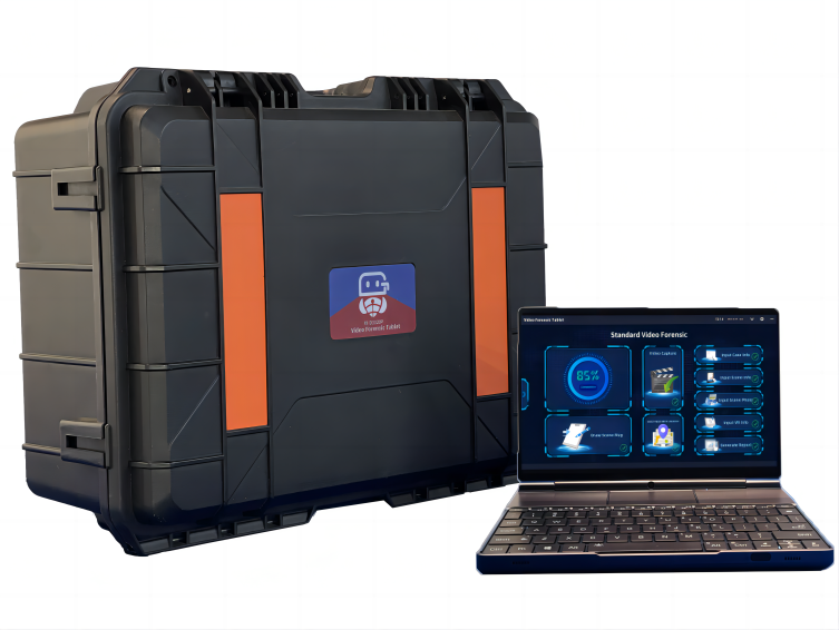
A portable device that meets all the requirements for forensic from video sources. It can capture video files from community surveillance, home security cameras, dashcams, drones, and various other general video recording devices. The capture speed can reach up to 550MB/s. It also features fast video recovery, deep video recovery, fast on-site video mapping tool, and one-click generation of video investigation reports. With a weight of only 1050 grams, it is truly lightweight and portable while offering comprehensive functionality.
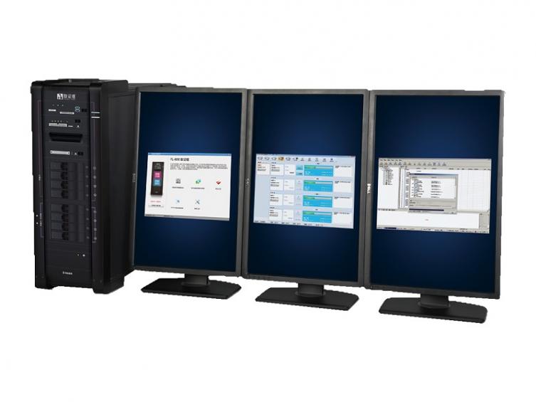
Enable disk duplication, imaging OS emulation, data recovery and analysis. Help investigator to duplicate large amounts of data in a short time. Bundled with forensics analysis software.

Rotor type: six-rotor Altitude limit: 5000mm Wheelbase: 1600mm Maximum horizontal flight speed: 44km/h Maximum mission payload: 20kg Maximum take-off weight: 45kg Battery life: 45 minutes (12kg payload) Communication distance: 10km
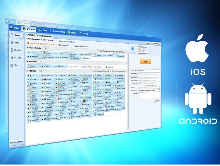
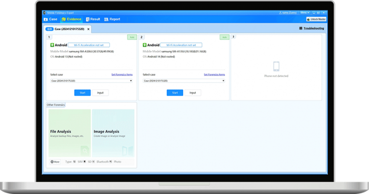
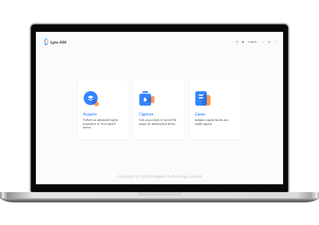
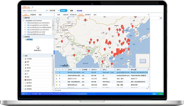
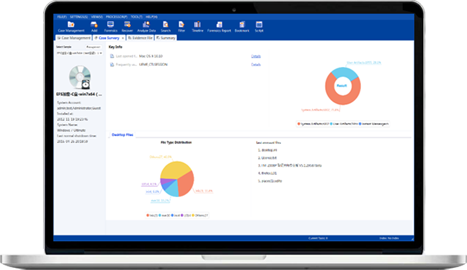
Extract data fromsocial media,variety of application. Provide specialway to unlock cellphone. The report is generated automatically. Mobile Forensics System assists investigator to find out critical evidences quicker and more efficient.

wheelbase :738mm Expand size :580*590*188mm Folding size :342*194*118mm Maximum horizontal flight speed :44km/h Maximum Mission Load :1.5kg Maximum takeoff weight :7.5kg Battery life :20 minutes (load 1.5kg) Communication distance :10km


